Awesome!
Would love to be standing there watching that mighty Burdekin River in a major flood.
Many thanks Peter, as I hoped to spot a video sometime soon.
How's the crocs wandering about the cane fields about your place?
We haven't had the huge rain around here, just had constant monsoonal wet with fairly normal flooding, so crocs being swept passed the back steps is a bit further north

Local roads have been a day to day proposition often depending on tide and the Bruce highway just south of here at Goorganga Plains has also been closed at different times over the last week or so which of course means plenty of people fishing for Barra off the roadside there. One bloke caught one, looked like must have been close to a metre but from pic it was a real bronzy colour so doubt if it would have been any good eating - too long in those freshwater muddy channels!!
BTW Mark, Groper Creek would be an interesting spot at present don't you think

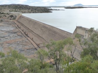
Sounds bloody scary! Where the fork is all that water gonna drain to? i hope they're safe downstream. 6m over the top of the spillway!!!
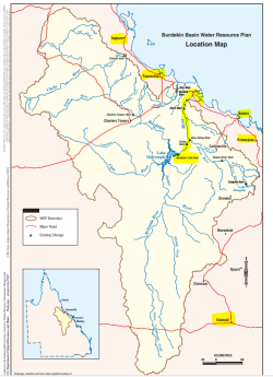
This much water in the Burdekin certainly causes some widespread pain! Charters Towers has been cut off in all direction but I think is now clear over the Macrossan bridge.
Plenty of other flooded areas, a bit of concern that Home Hill could be flooded with all that water coming down the river, certainly caused flooding at Plantation Creek at Ayr.
If you have ever crossed the Burdekin bridge at Inkerman when the Burdekin river is in flood, it is a sight to behold!!
And of course discounting the Burdekin, shouldn't forget the main disaster areas around Ingham and Cardwell with the Herbert River reaching record peaks