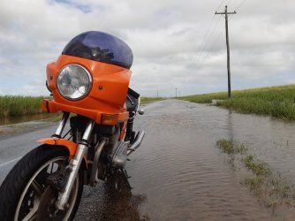
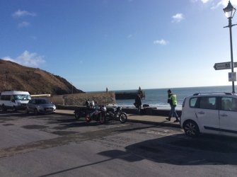
Weather where you are?

Is this the lake/reservoir we rode to when I was over there? Is there really 6m of water pouring over that spillway?
Hi Michael, no we rode to Lake Proserpine which is much much smaller and just west of Proserpine (and quite a small catchment).
As you can see from the map, this dam is also due west however no direct road so you have to go up to around Ayr, head west and then back down to the dam which is over 420kms or considerably further if you wish to avoid the dirt..............
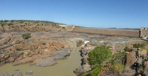
And yep, really 6m over spillway. If you look at video you can see water is not only over spillway, it is up to the actual ends of the dam you can see in my pic taken in the dry.
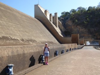
BTW, you can drive down to the dam and drive across in front of the spillway which links to a road heading south which is quite rough and 4wd only. Just to be annoying I have attached another pic (which might show it better) from the bottom of the spillway where you can drive across.
Of course it was hot so we walked down and across instead!!! And one from below looking toward dam which might show better how big the raging torrent is (Edit - Should have said - Spillway is 504m long.)
P1030492.JPG

P1030497.JPG
 
Last edited:
When they start talking about a mitre of rain, that's nuts.
The Daintree got 5500mm in ten days last wet season from a stationary trough. When we were at Cape Tribulation in Sept there was not an insect, bird, animal, returned even then. We saw nothing on a guided spotlighting in the rainforest. It was eerie, no mosquitoes even. Prior there were two visible landslips in the ranges, now there are 230 or so.
All that Burdekin silt runoff goes onto the great barrier reef.
 
And yep, really 6m over spillway. If you look at video you can see water is not only over spillway, it is up to the actual ends of the dam you can see in my pic taken in the dry.
(Edit - Should have said - Spillway is 504m long.)
and still rising..
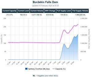
Historical high is 221% back in February 1991
BurdekinDam_10Feb.jpg
 
The increase in the surface area of the dam's water must be insanely huge ... it's not as if it's steep hilly terrain.

And took less that 2 days to nearly double in capacity. A proper wet, if a few months late!
 
The increase in the surface area of the dam's water must be insanely huge ... it's not as if it's steep hilly terrain.

And took less that 2 days to nearly double in capacity. A proper wet, if a few months late!
Nah, Quentin, quite normal time for a monsoonal trough......
The Daintree got 5500mm in ten days last wet season from a stationary trough. When we were at Cape Tribulation in Sept there was not an insect, bird, animal, returned even then. We saw nothing on a guided spotlighting in the rainforest. It was eerie, no mosquitoes even. Prior there were two visible landslips in the ranges, now there are 230 or so.
All that Burdekin silt runoff goes onto the great barrier reef.
Hi Tippie, yep most of the area adjacent to Qld coast is part of the GBR Shelf and GBR Marine park but of course the actual reef is a considerable distance away from this area of the coast. Your comment did however remind me of GEO-Science study I had seen which may be of interest (or may not!!) Link - https://wetlandinfo.des.qld.gov.au/...t-stories/lower-burdekin/fieldingetal2003.pdf
This study documents the finding of a large paleochannel channel which evidences the route of the Burdekin river from the present coast all the way to the outer reef 160km away!
This was the Burdekin River route during the sea level drop during the last glacial period and subsequent sea level rises since which were at times rapid, other times quite stable.
Study also notes:-
The Burdekin River (Fig. 1) dominates fluvial discharge on the northeast Australian margin, annually adding 9.8 x 10⁹ m3 of water and 3 – 9 x 10 6 tonnes of sediment to the GBR shelf (Neil et al., in press). These figures are nonetheless modest when taken in a global context and reflect the relatively subhumid climate, tectonic stability and great antiquity of the Australian landscape.
Many other interesting findings in this study which apparently goes against previous studies in regard to behaviours of rivers during sea level drops.
Obviously a lot of technical terms which I don't understand but I found it fascinating, hope someone else does.
(Perhaps I should get a hobby:cry:)
 
There was a lot of talk about farm runoff, pesticides and fertiliser from the coast to the reef years back. Not so much lately.
 
I don't know if the reef has that issue but The Darling River sure does. Blooms have killed incredible numbers of fish over the years in that river. That's not helped by drought or overuse of irrigation or chemicals used in cotton crops. Poor use of irrigation is a long-term stain on the country. It's incredibly complex with big money involved and Politics not helping either. Water access and use in so important in an arid country.
 
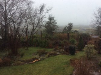
A photo from yesterday and then today - mist, heavy rain and 70mph winds!
 

Attachments

  • 1FB3AAF4-2E54-49E0-BC49-053BEBB3849A.jpeg
    1FB3AAF4-2E54-49E0-BC49-053BEBB3849A.jpeg
    108.1 KB · Views: 20
  • E8AE120C-0F25-43C7-B153-B4EF0DEDC812.jpeg
    E8AE120C-0F25-43C7-B153-B4EF0DEDC812.jpeg
    163.2 KB · Views: 20
Chris, where do I get the idea that the usual road limit was 40 tons? I did some work at The Power House Museum once and they were looking to rebuild a Steam Locomotion. They got replies from Engineering shops, but it weighed more than 100 tons so road transport was a no-go. They needed track access. And then you see those Space X rockets being moved on multi-wheel transporters.

106 tonne without a permit, I believe… on a road train rated road.

Was listening to a bloke on the UHF telling his mate he was 120 tonne. I wouldn’t be advertising it 😳

Nice day in Brisbane
 
Back
Top